The Rhinogydd, often anglicised as Rhinogs or Rhinog Traverse, take their name from the two principal peaks Rhinog Fawr and Rhinog Fach and form one of the most uncompromising parts of the Cambrian Way. Rocky, steep and frequently pathless, they reward careful route-finding rather than speed. The Cambrian Way crosses the range as a distinct stage linking lowland approaches with the higher Snowdonia ridges, and the section is used by major mountain races such as the Dragon’s Back and Dragon’s Fire. Key summits to know are Y Llethr (756m), Rhinog Fawr (720m) and Rhinog Fach (712m), and features such as the well-preserved Roman Steps, a medieval packhorse trail, lead you into the heart of the range. The Rhinogydd are much less popular than the northern ranges, so in the dry season (if there are any in Wales!?) it should be easier to find discreet wild-camp pitches here, with hidden tarns ringed by crags offering some of the best secluded campsites in North Wales.
Trail Stats At a Glance
Day 1: Trawsfynydd to Moel Ysgyfarnogod
| 📅 Thursday, 14 May 2026 | 🥾 14.9 km/9.26 miles | 📈750m/2,500 ft | 📉 400m/1,300 ft |
Most bloggers seem to blitz the Rhinogydd in two days and finish at Barmouth. We decided to take it slower because we frankly had the time and fewer ankle twists sounded appealing. I booked a parking slot at the Dolgellau Co-op via JustPark since long-term parking in Barmouth was impossible to find. This meant we started from Trawsfynydd on the T2 bus instead of the usual west-side or north-side approaches. When we arrived, every space at the Co-op was taken. Someone pulled out five minutes later and saved us from a two-hour bus wait, which was the kind of tiny miracle that turns a potential disaster into a good story. Poppy contributed to the drama by insisting on a perfectly timed toilet break mid-dash for the bus.
We’d planned the scenic crossing of Llyn Trawsfynydd via the footbridge at the reservoir’s southern end, but the bridge was fenced off [1] and clearly long out of use. Graffiti on the far side made that obvious, so we had to go back to where we started. The worst of the wet stuff hit in the first few kilometres as we headed for the bridge: the paths were sodden, slow and squelchy. Once past that stretch, we joined the paved lane around the reservoir and made steadier progress, then left the tarmac for the stony uphill toward the Rhinogydd [2], swapping easy miles for rough or soggy ground and a growing concern about finding a decent, dry spot to pitch for the night.
After just over 6 km the first climb appeared at Moel Gyrafolen (537m) and it promptly rewarded us with a lunch stop and the kind of view that makes a freeze-dry sachet taste like a Michelin meal [3]. We’d hoped that anything above 500m would be a bit drier, but that turned out to be wishful thinking. The ground stayed either water-clogged or gloriously rocky, and the worry about finding a decent camping spot started to lurk at the back of our minds.
Next up was Diffwys (577 m) — which, confusingly, isn’t the official summit of Diffwys on the Rhinogydd. That one appears on Day 3. Welsh mountain naming: beautiful, poetic, and occasionally out to troll you. Then the route skirts Foel Penolau (614m) with its characterful rocky summit. We left the backpacks (and Poppy, since her legs are too short for that scramble) and scampered up for a quick look. The summit rewarded us with an indie-album-cover selfie and the kind of smug satisfaction only earned views can buy [4].
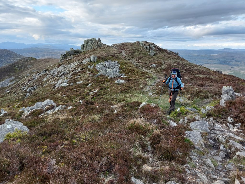
On the descent, the first decent camping opportunity showed itself. We noted the distance and pushed on toward Moel Ysgyfarnogod (623m) [5], where the south side opens out into a string of grassy pitches. The Cambrian Way drops the ridge toward the west at the saddle, but it doesn’t cross the west-facing summit, so we skirted the high line and continued with high hopes for an epic lakeside pitch by Llyn Ddu [6], only to be disappointed by waterlogged grass all around. We carried on, hoping that the climb toward Corn-y-stwc (594m) would bring drier ground, but unfortunately, there was only bog and rock. Practicality won: we backtracked about 2 km to the south edge of Moel Ysgyfarnogod, fetched water for the evening from Llyn Ddu and set up camp on a sheltered, dry ledge. That evening, we were treated to a wind-free, sunny spell and a rainbow arcing over the ridge [7]. It was a cinematic finish to the day, only occasionally interrupted by the rather peculiar cries of the local Welsh sheep (they are much more dramatic than the Cumbrian and Kentish ones!).
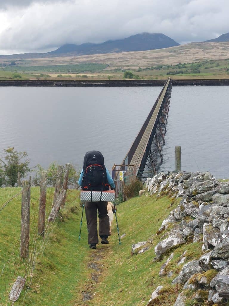 [1] [Not] Crossing the iconic Trawsfynydd lake bridge to kick off Day 1 of the traverse. Sadly, the bridge was closed [Photo: A. Scibor]
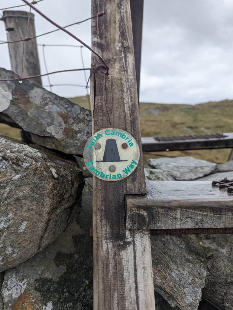 The iconic Cambrian Way (Taith Cambria) marker emblem on one of the ridge’s many mandatory ladder stiles.
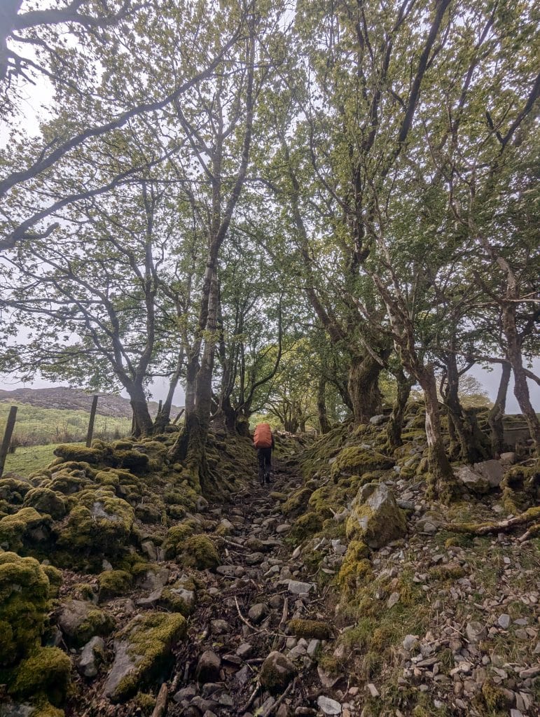 [2] Stony uphill toward the Rhinogydd feels like moving through time, following ancient, sunken drovers’ lanes blanketed in centuries of deep moss.
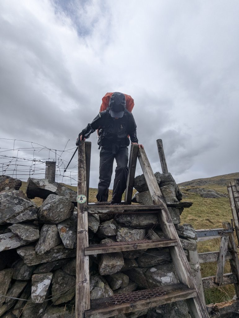 Day one kicked off with pathless approaches, waterlogged valleys, and standard Welsh drizzle.
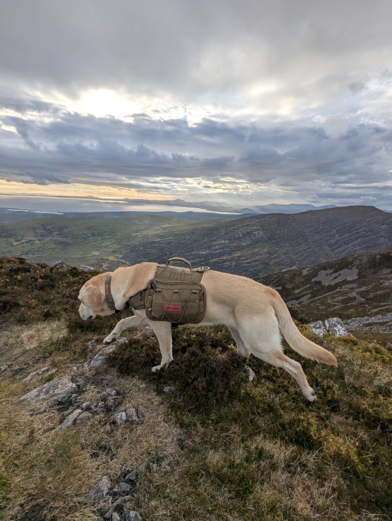
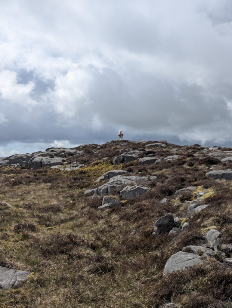 Poppy doing what she does best: scouting ahead on the untracked ridges to find the path of least resistance through the rocks.
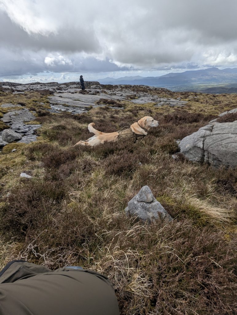 Dropping her weight and completely switching off, teaching a high-energy dog to genuinely relax during trail pauses is a total game-changer for multi-day endurance.
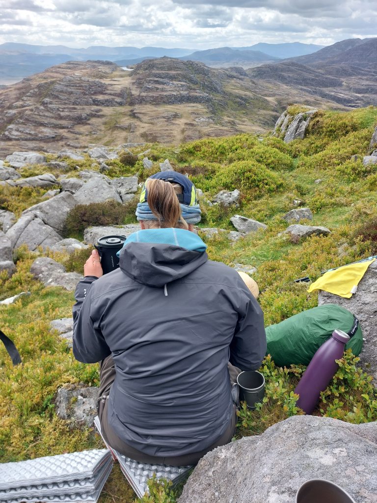 [3] Moel Gyrafolen rewarded us with a lunch stop and the kind of view that makes a freeze-dry sachet taste like a Michelin meal [Photo: A. Scibor]
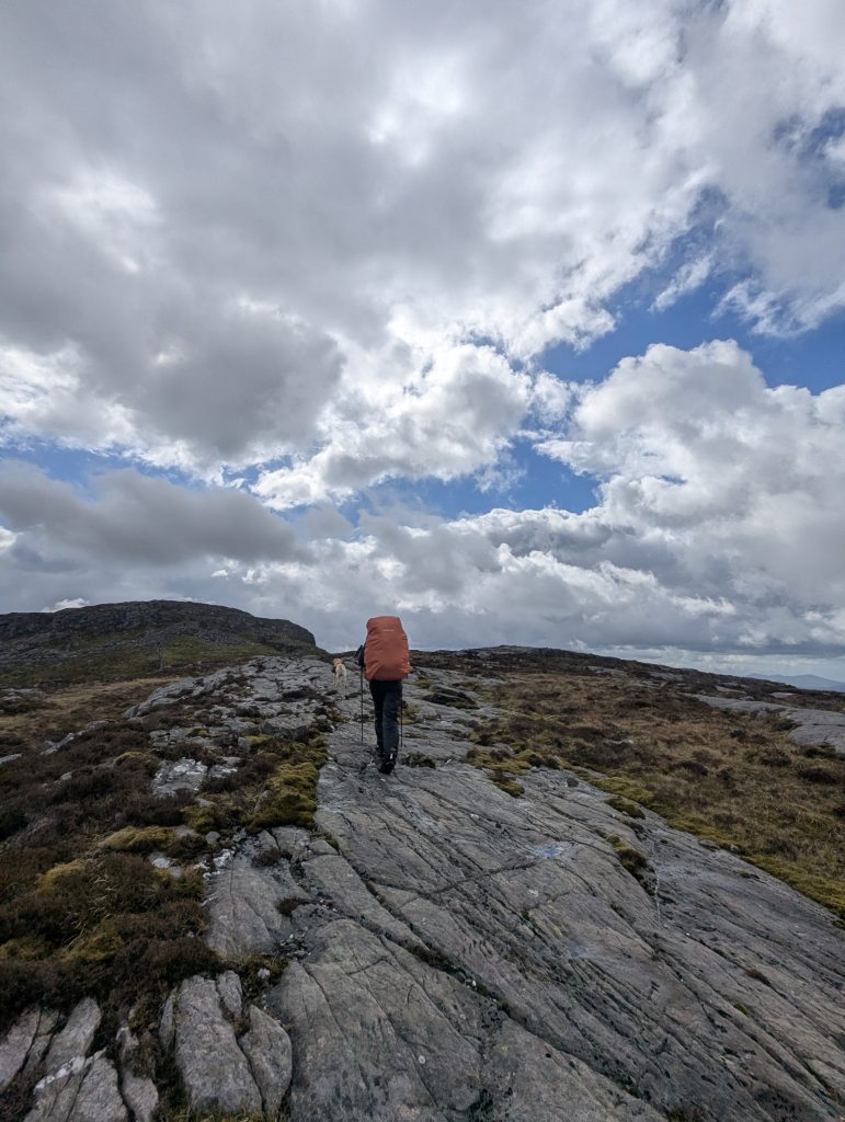 Following the sweeping, glaciated stone highways that ripple across the highest sections of the traverse.
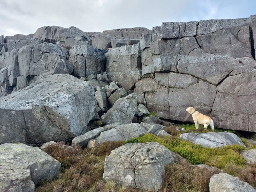 Leaving the heavy backpacks behind for a quick, unencumbered dash to the top of Foel Penolau [Photo: A. Scibor]
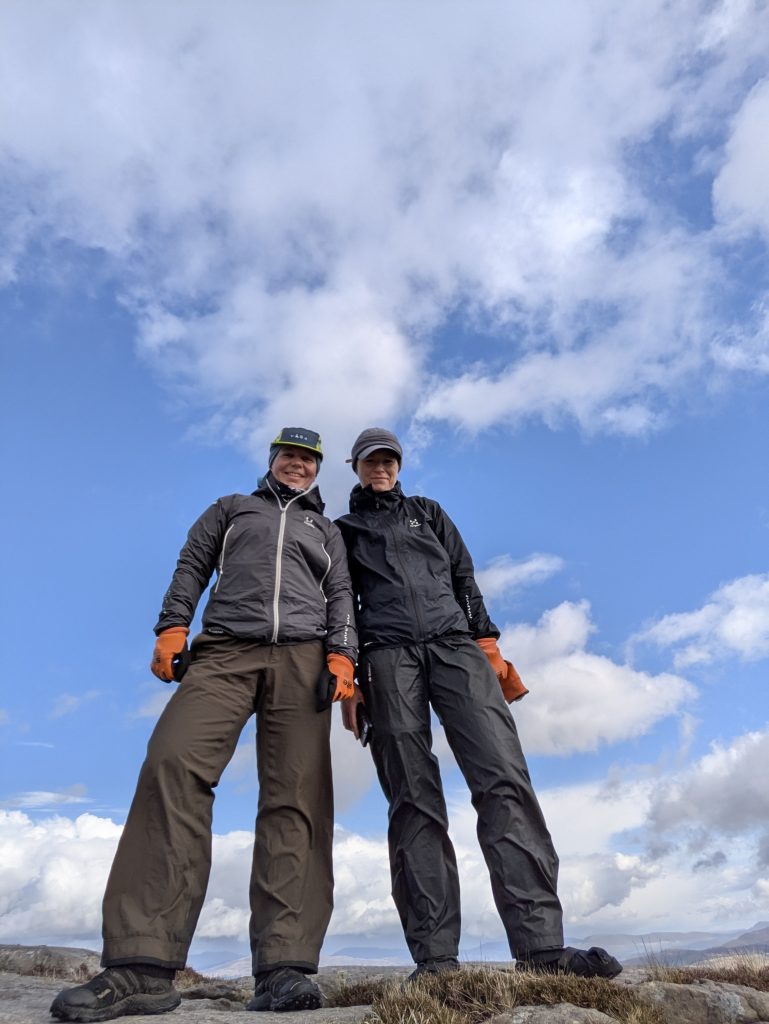 [4] Foel Penolau summit rewarded us with an indie-album-cover selfie
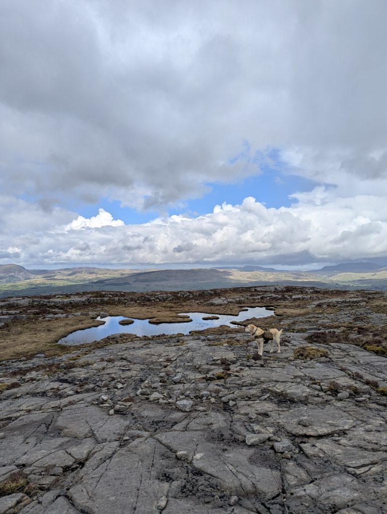 Navigating the high, craggy plateaus where exposed gritstone platforms mix with hidden pools and sweeping horizons.
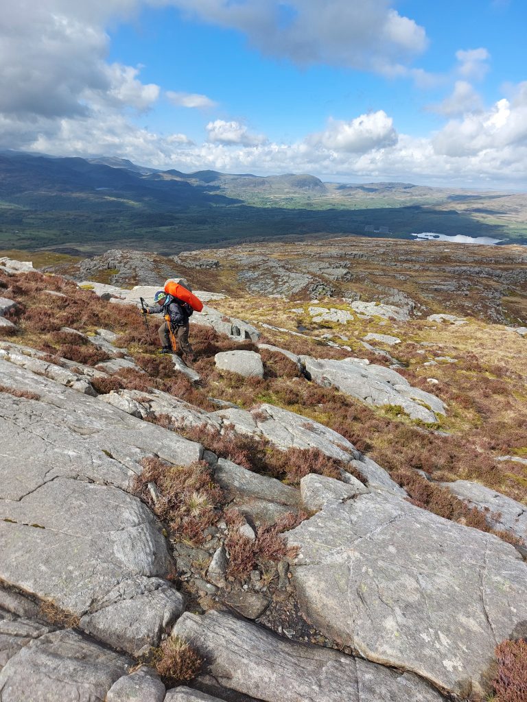 The ground stayed either water-clogged or gloriously rocky, and the worry about finding a decent camping spot started to lurk at the back of our minds [Photo: A. Scibor]
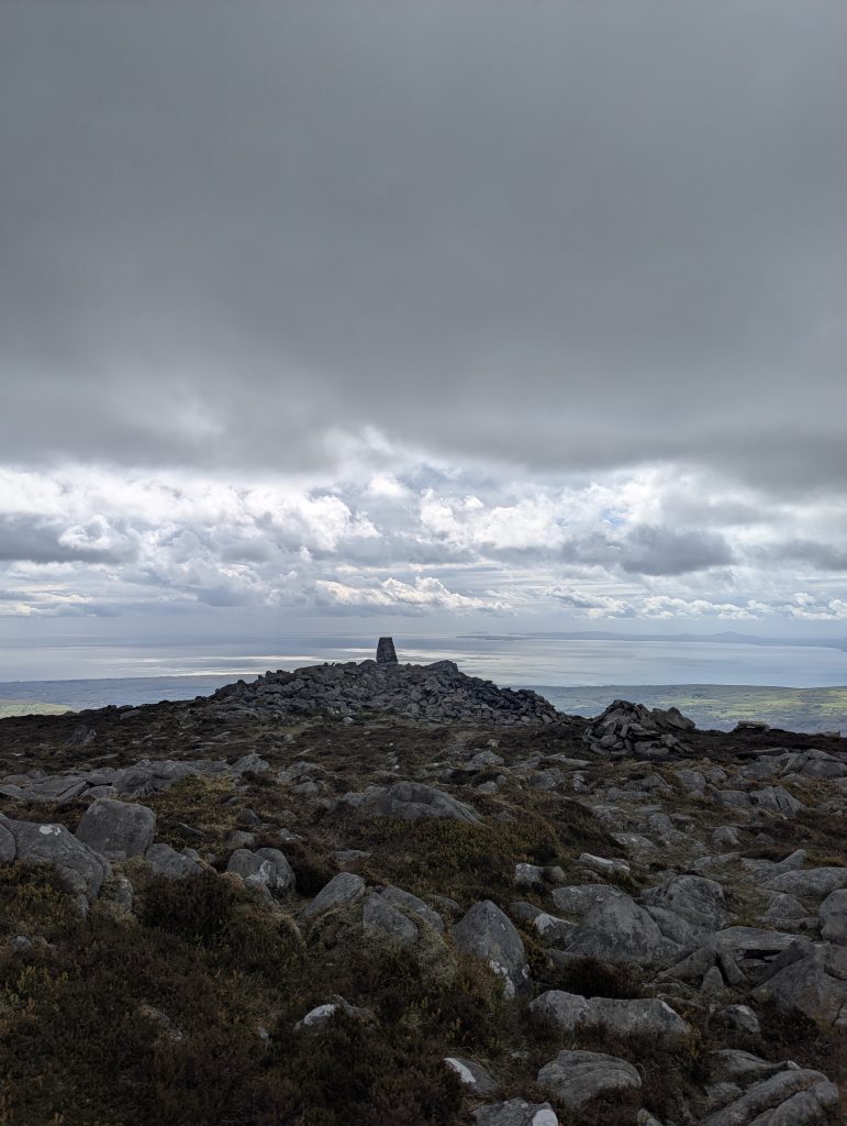
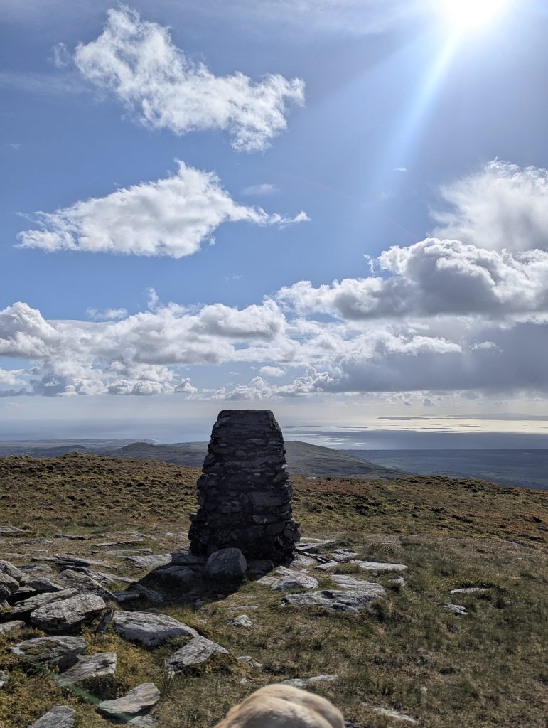 [5] Reaching Moel Ysgyfarnogod summits where the stone markers stand against wide-open coastal horizons and well-earned sunshine.
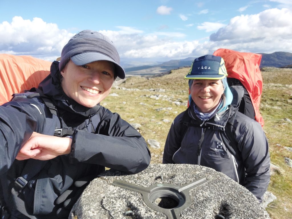 Obligatory Selfie with Moel Ysgyfarnogod trigpoint [Photo: A. Scibor]
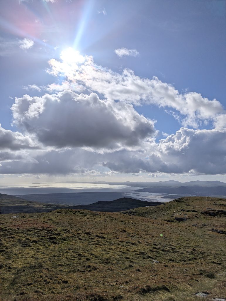 View of Porthmadog from Moel Ysgyfarnogod on a very good day
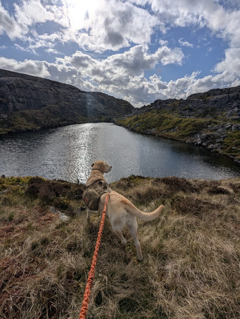 [6] We had high hopes for an epic lakeside pitch by Llyn Ddu only to be disappointed by waterlogged grass all around. Still an excellent spot to fetch water
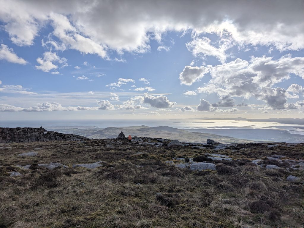 The massive scale of the southern plateaus, where the rugged rock finally relents to open grassy ridges high above the sea.
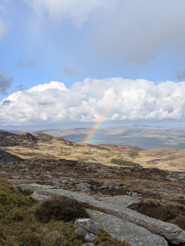 [7] We were treated to a wind-free, sunny spell and a rainbow arcing over the ridge
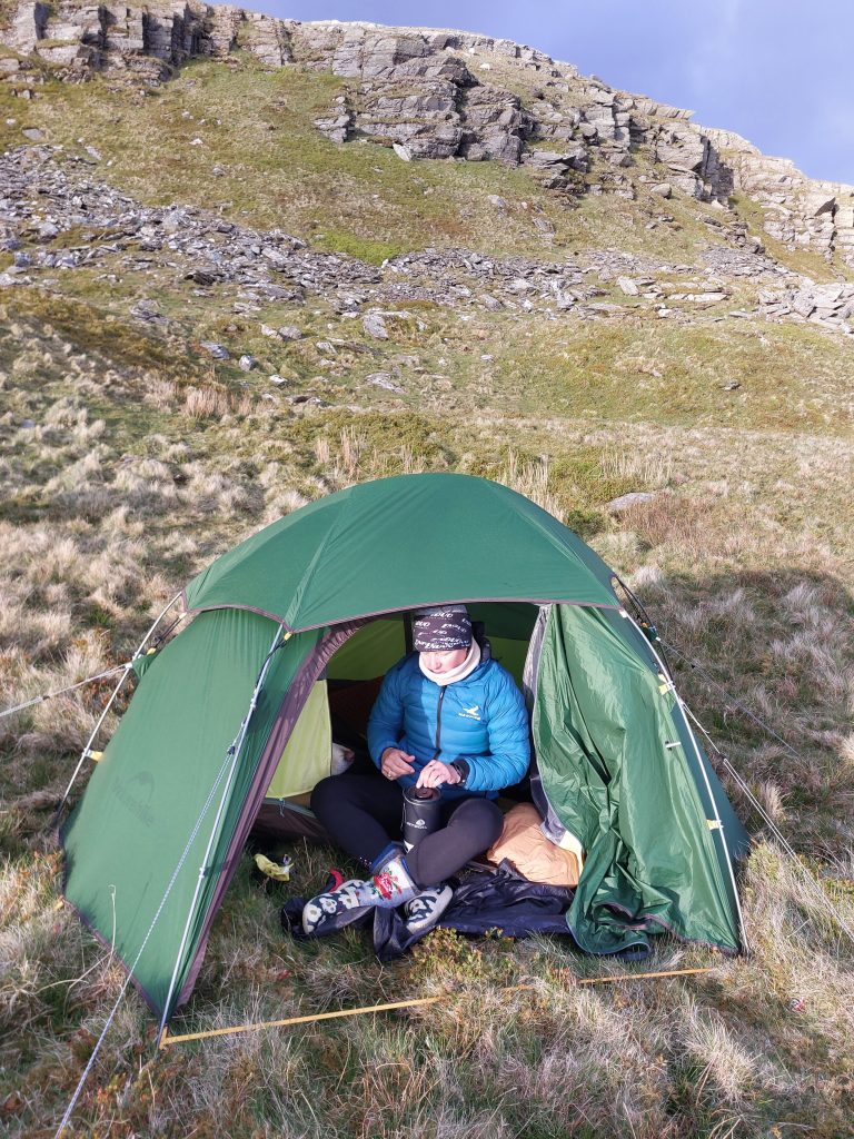 When lakeside bogs rule out the tarns, a high rocky shelf makes the perfect tactical wild camp [Photo: A. Scibor]
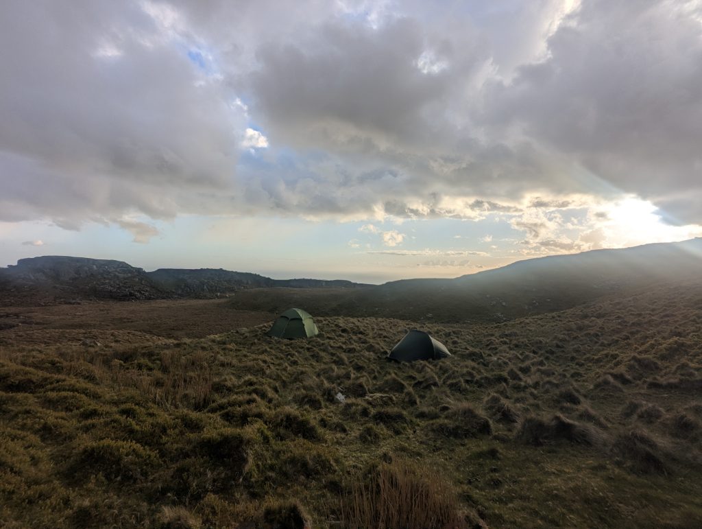 In the end, it was a pretty good camping spot
Day 2: Moel Ysgyfarnogod to Llyn Hywel
| 📅 Friday, 15 May 2026 | 🥾 16.4 km/10.2 miles | 📈1,050 m/4,100 ft | 📉 1,300 m/4,300 ft |
Day two delivered everything the other bloggers had promised: technical, pathless scrambling where you pick a line, hope it doesn’t get worse, and swap bog-and-rock for rock-and-heather. The morning dawned bright and sunny, and because we were conscious of the mileage ahead, we were up and moving earlier than our usual standards allow. Having smugly declared there hadn’t been a soul on the horizon for 24 hours, we promptly bumped into another hiker heading north. It turns out he was following the Snowdonia Way, which we hadn’t even realised was signposted there. Small world, smaller hills.
We skirted Corn-y-stwc (already ticked off the day before) and dropped down toward Llyn Corn-y-stwc [8], where the path disappears. You descend, cross the wall, head down to the Llyn, and then the Cambrian Way skirts the bank to the right instead of the left. It is tempting to cross and admire the view because the lake does have an infinity-pool vibe [9]. Next, the climb toward Craig Ddrwg (596m) begins, and the full face of Rhinog Fawr opens up, but first there’s a steep drop to Llyn Cwm Bychan, a large, road-accessible lake with a campsite rumoured to run on an honesty-box economy.
We loved the little woods around the early section. They were mossy, ancient and perfect for a brew, and we topped up water from the streams [10]. The terrain then graduated from soft moss to big, slippery slabs [11] and finally to rough, boulder-strewn ground [12]. Llyn Du appeared at the foot of Rhinog Fawr [13] and Poppy celebrated by splashing about and fishing out rocks [14]. Then the inevitable scramble began with no obvious path, just bearings, the least intimidating pile of rocks and a lot of optimistic heaving [15]. I kept Poppy behind me to check the line, only to discover she was handling the scramble far better than I was: small legs, big attitude.
At least there are no false summits. You scramble over increasingly large, sometimes loose rocks and then, suddenly, you’re up. A solid trig point marks the top [16]. We found a neat little windbreak built from stones and declared it the perfect spot for lunch [18], with a clear view of what was coming next – Rhinog Fach [17]. The descent was surprisingly straightforward. I’d been bracing for a dramatic, cliff-hanger drop, but it turned out to be a steep path through heather and scattered rocks. We bumped into a cheerful group from Dorset stretching their legs after a long drive, then a father-and-son duo (the son was doing the whole Cambrian Way and his dad had joined him at Barmouth). For a few minutes, it felt like Oxford Street, just the hill edition.
Approaching the foot of Rhinog Fach the route squeezes through a wall via a tiny dog-gate rather than a human ladder [19], so we skirted right, picked out the scramble line and paused for a quick breather [20]. The climb looked worse than it was, but it teased us with several near-summits that broke our hearts and raised our pulse rates in equal measure [21]. Time was starting to loom. We were banking on finding a camp by Llyn Hywel based on other bloggers’ reports, and those reports had clearly enjoyed drier weather than we had. After the summit, we began the descent but went a touch too far, since the route runs along the wall near the top, so we corrected course and carried on [22].
Fatigue and doubt about finding a decent pitch started to creep in as the scramble down took longer than we’d hoped. After picking our way over loose stones and another cheerful pile of boulders, we dropped toward Llyn Hywel and negotiated the rocky bank to reach the grassy edge [23]. It was flat, but suspiciously waterlogged. With rain forecast overnight, we weren’t about to gamble. We pushed on to check out Llyn Perfeddau and eventually settled on a small, slightly raised hill between the two lakes: dry underfoot, sheltered enough and with a glimpse of sunset.
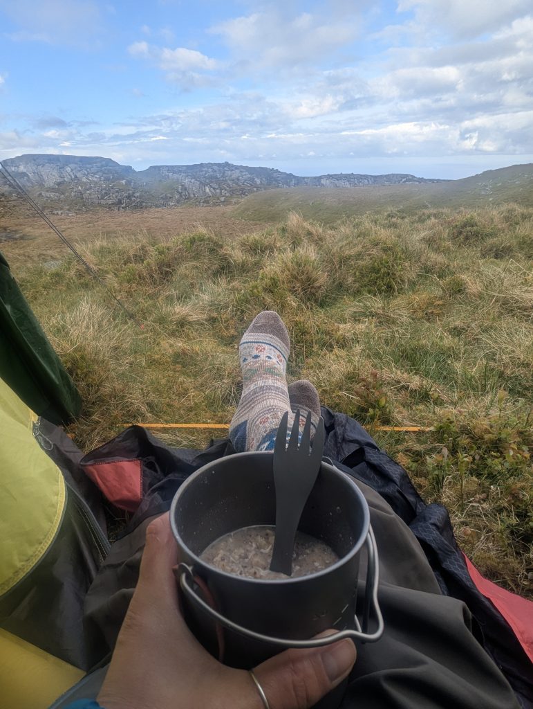 Brekkie with a view
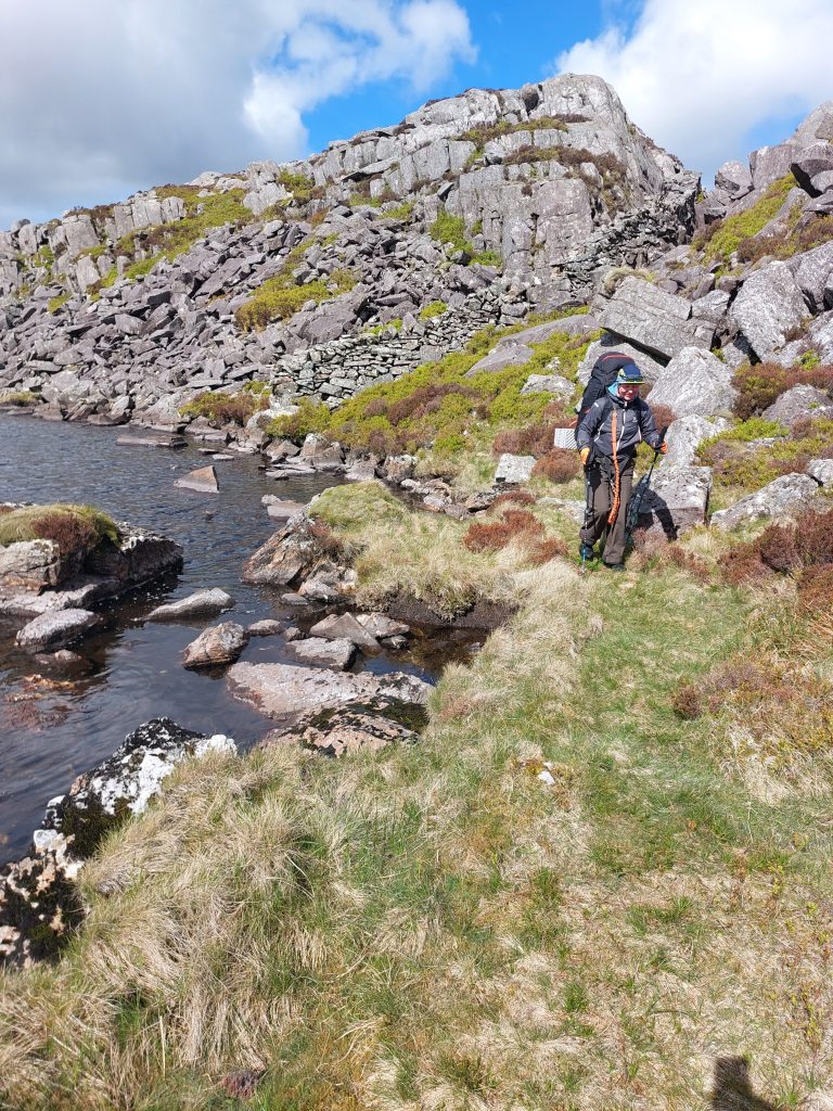 [8] dropped down toward Llyn Corn-y-stwc, where the path disappears. BTW going wrong way, you need to go along the rocky bank [Photo: A. Scibor]
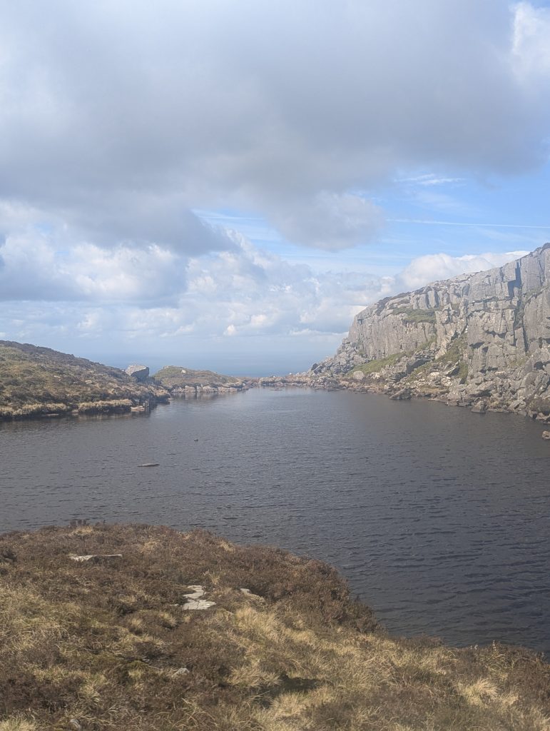 [9] infinity-pool vibe of Llyn Corn-y-stwc
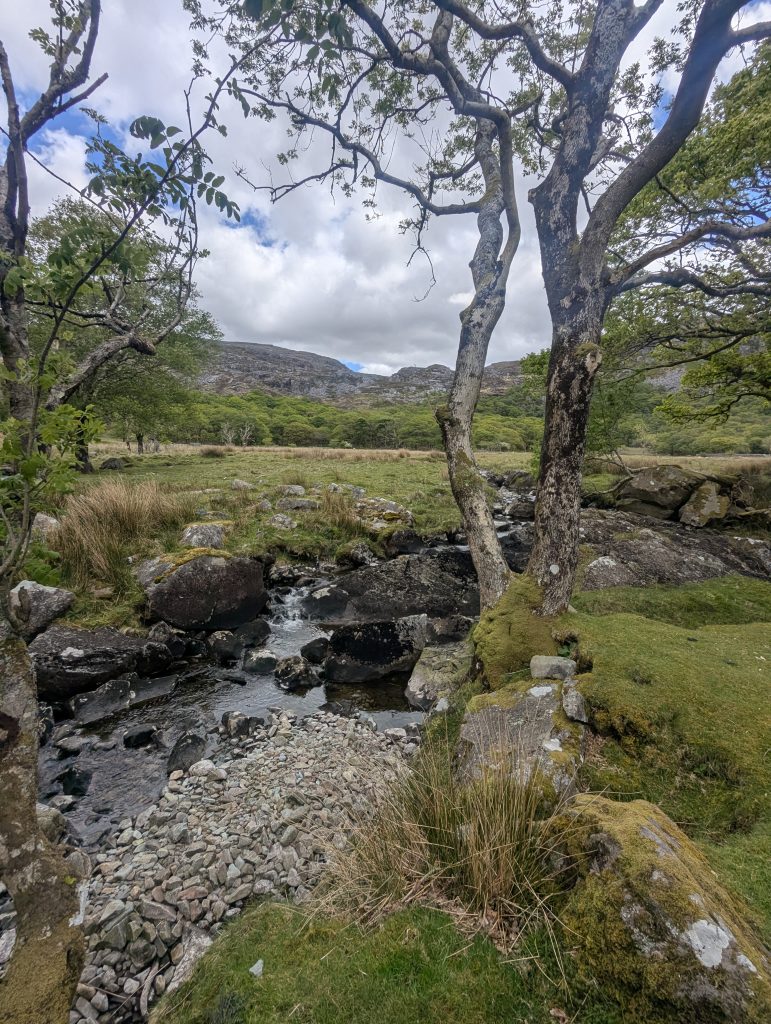 [10] We loved the little woods around the early section. They were mossy, ancient and perfect for a brew, and we topped up water from the streams
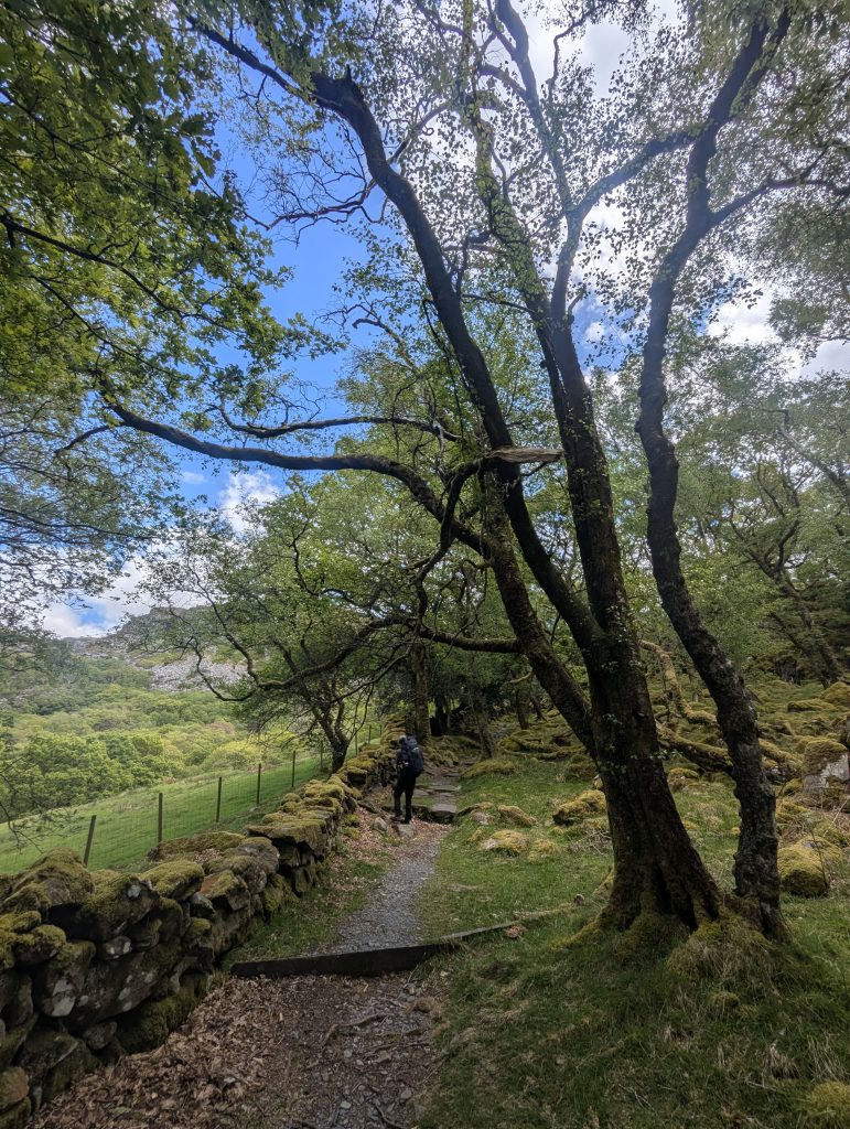 Ancient woods leading to Roman Steps
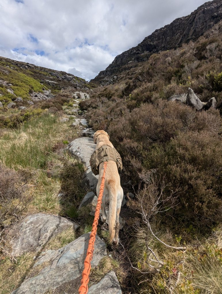 [11] The terrain then graduated from soft moss to big, slippery slabs
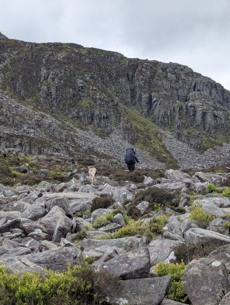 [12] The infamous boulders
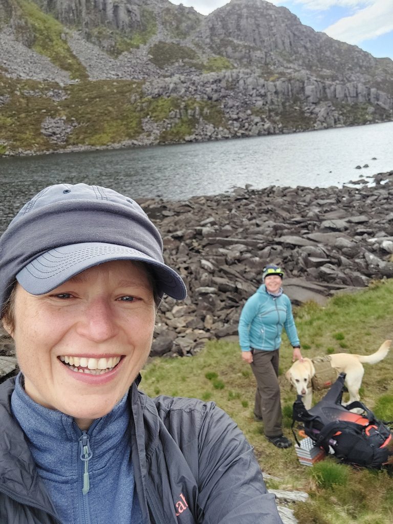 [13] Llyn Du appeared at the foot of Rhinog Fawr, pausing by the boulder-lined shores of a high tarn [Photo: A. Scibor]
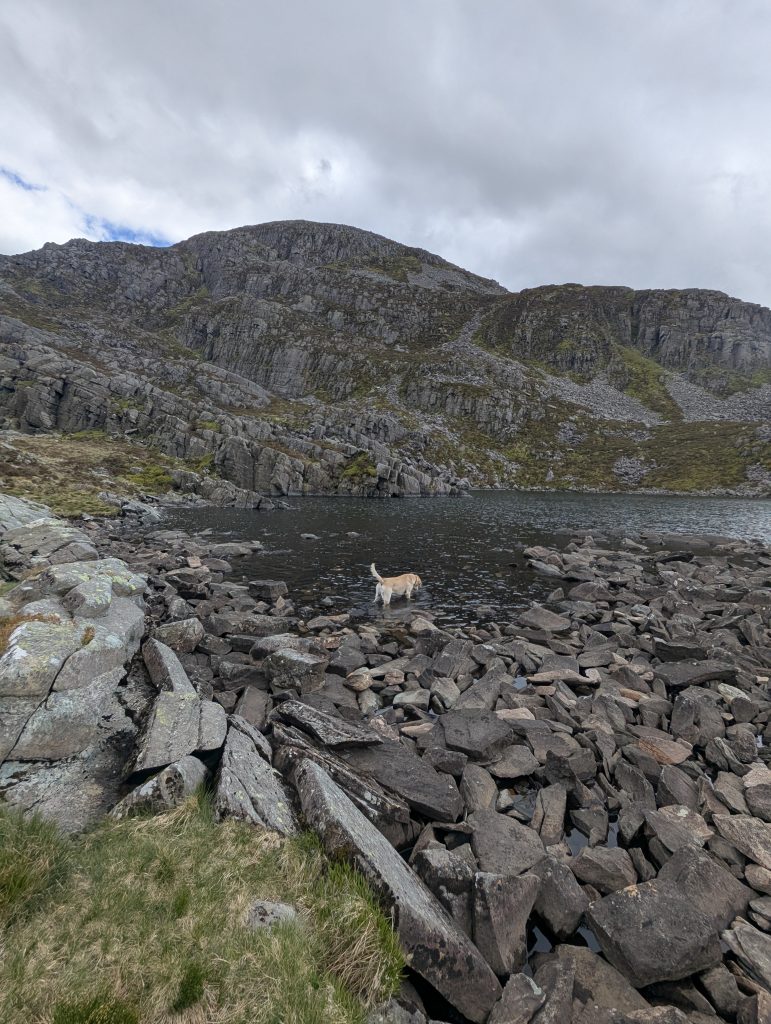 [14] Poppy celebrated by splashing about and fishing out rocks
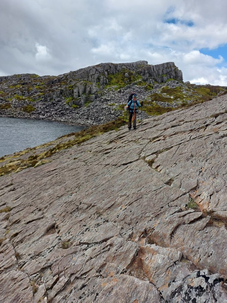 Navigating the massive, sweeping rock slabs that edge the high tarns requires grippy boots and total focus [Photo: A. Scibor]
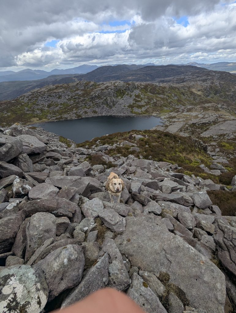 I kept Poppy behind me to check the line, only to discover she was handling the scramble far better than I was: small legs, big attitude.
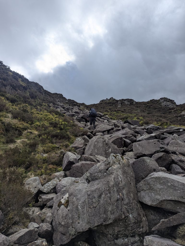 [15] We picked the least intimidating pile of rocks, and the scramble began
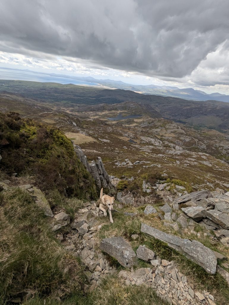
 [16] Rhinog Fawr trig point, no false summits, just straight up scramble
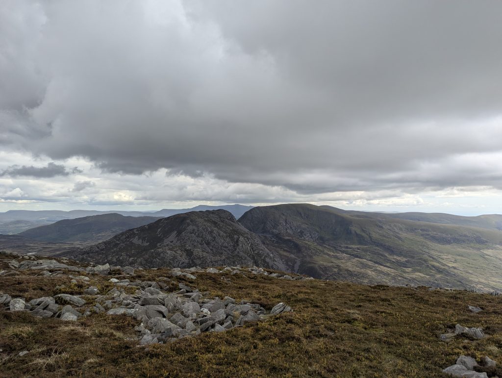 [17] A view of what is next – Rhinog Fach
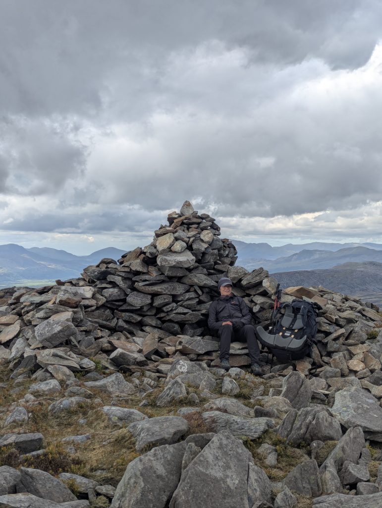 [18] perfect windbreak for a lunch stopover
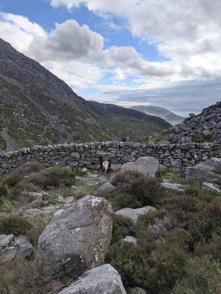 Approaching the foot of Rhinog Fach, the route squeezes through a wall via a tiny dog-gate rather than a human ladder
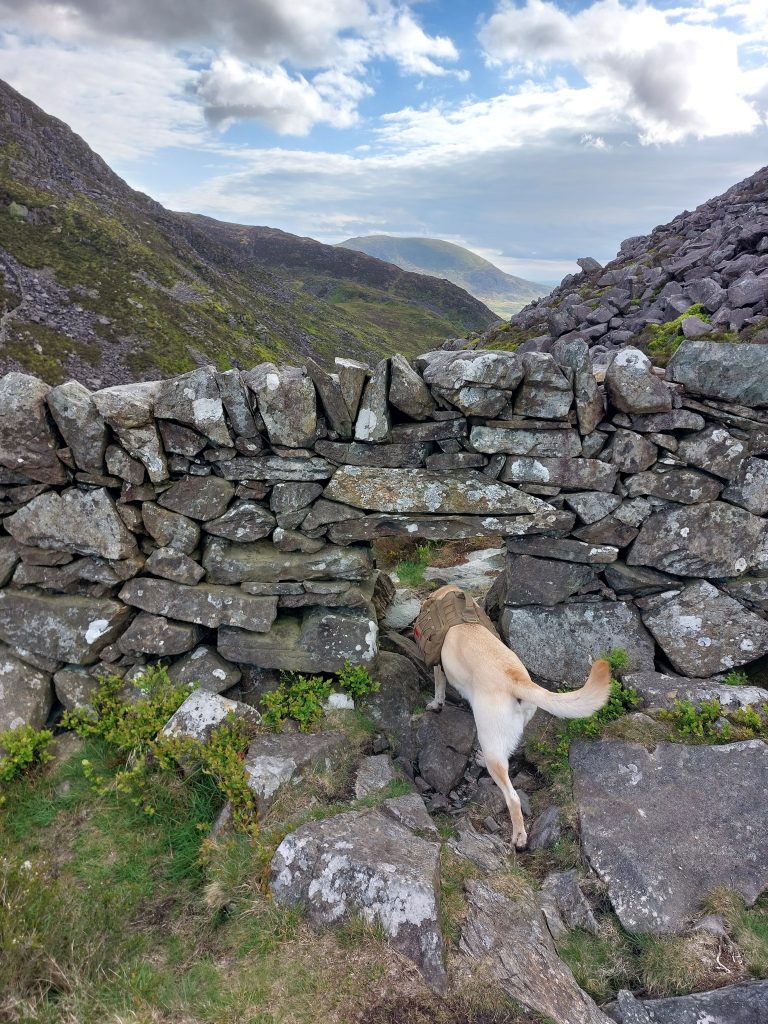 [19] Navigating the tiny dog squeeze crawls built directly into the ridge’s historic dry stone walls.
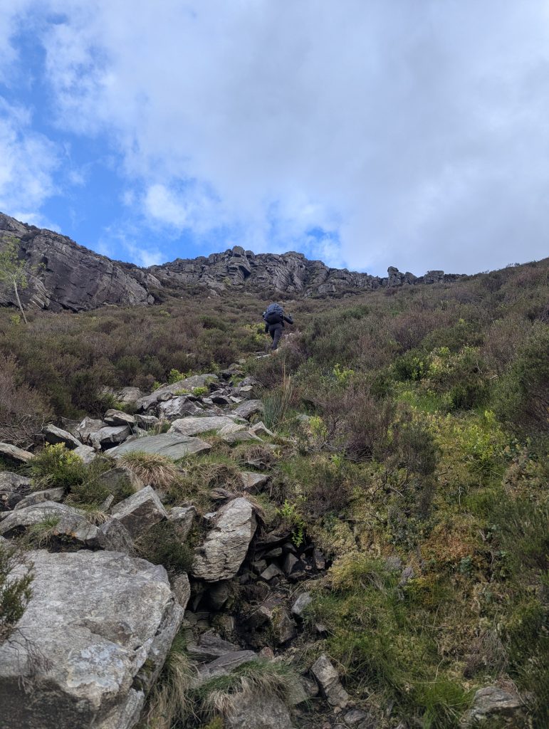 [20] picked out the scramble line – the climb looked worse than it was
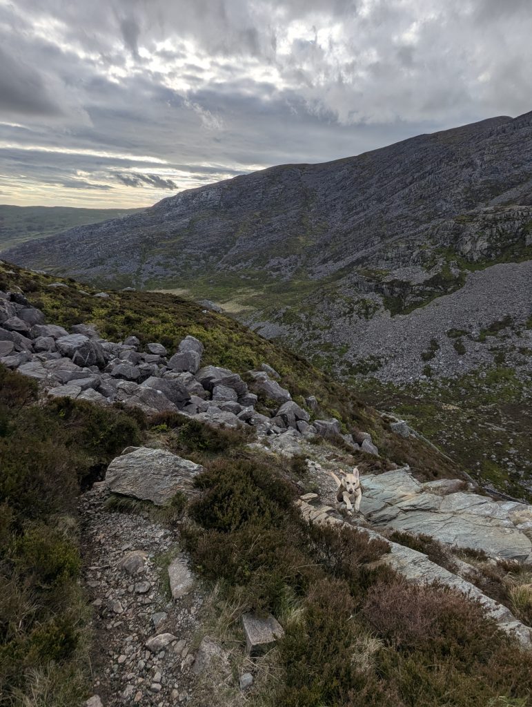
 Picking a line through the classic heather and rough gritstone outcrops that define the central spine of the range [Photo: A. Scibor]
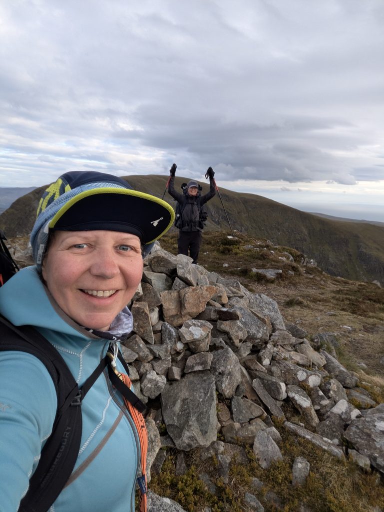 [21] Celebrating summiting Rhinog Fach – after multiple false summits which nearly broke my heart
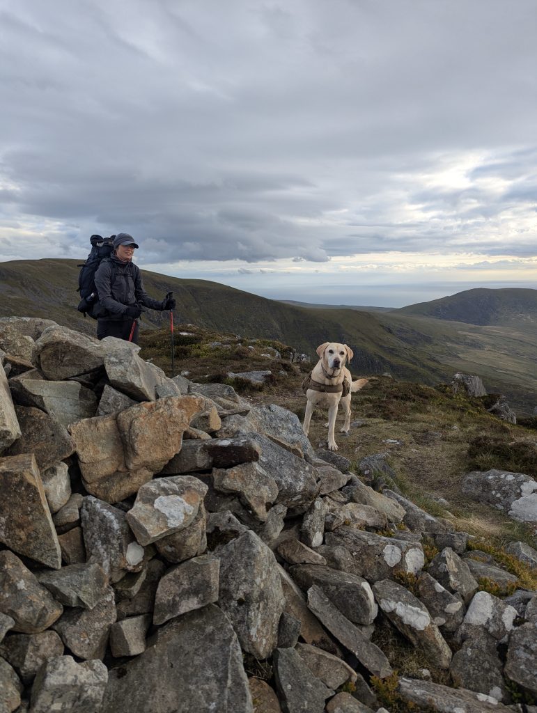 Poppy couldn’t believe it was the last one for the day
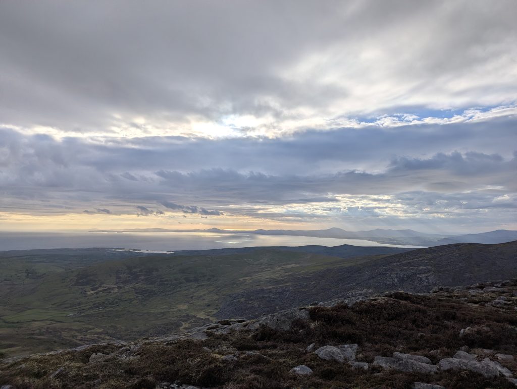 Spectacular views from Rhinog Fach
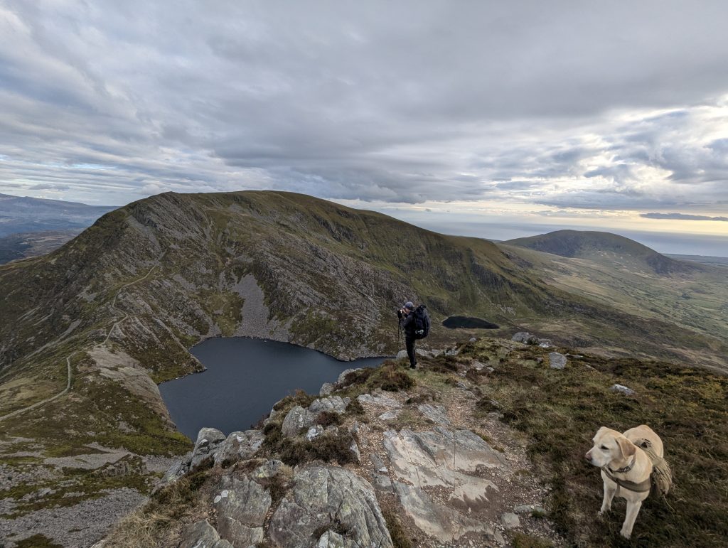 [22] If you got that view, you have gone too far, descent is along the wall
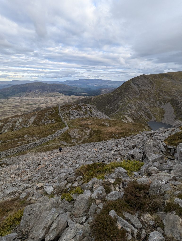 Descent from Rhinog Fach south side
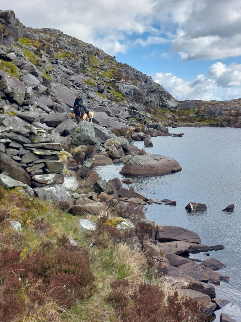 Negotiating the rough boulder fields flanking the high tarns requires steady footing and a lot of patience [Photo: A. Scibor]
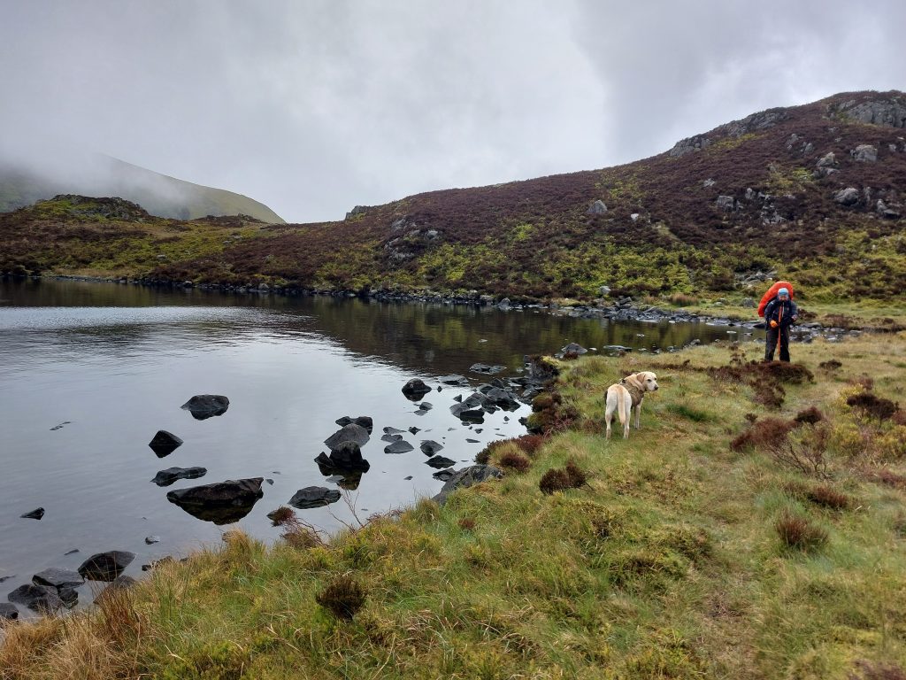 Scouting out the banks of the high tarns as the evening mist begins to settle over the col [Photo: A. Scibor]
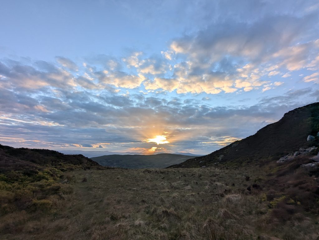 After a tough day, we were rewarded with a glimpse of the sunset
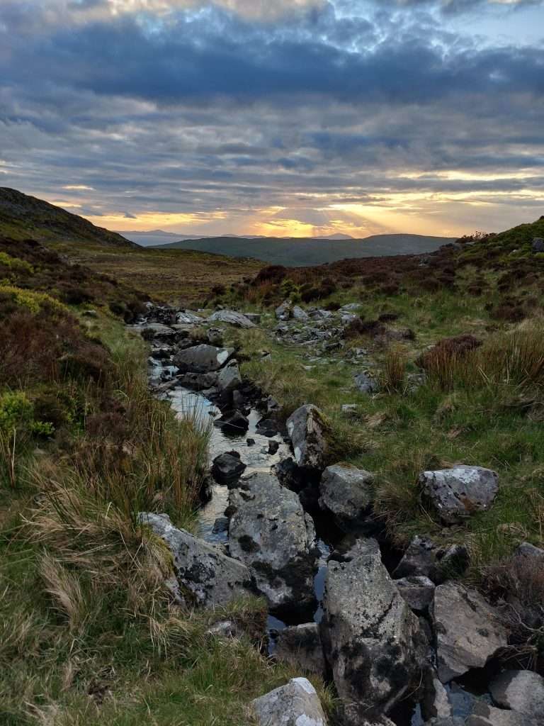 A cinematic sunset breaking through the clouds over a wild water source along the Cambrian Way.
Day 3: Llyn Hywel to Barmouth
| 📅 Satruday, 16 May 2026 | 🥾 17.5 km/10.9 miles | 📈780 m/2,600 ft | 📉 1,300 m/4,300 ft |
The forecast didn’t lie. It started raining in the evening and kept going all night. We were very pleased with ourselves for choosing a pitch that didn’t turn into a swimming pool. When it finally stopped in the early morning, I snapped a moody photo of our campsite with Llyn Hywel lurking atmospherically in the background [24].
With rain forecast for most of the day, we made the executive decision to abandon the original plan of another wild night and a bearing-based wander toward Dolgellau. There was no clear route, the ground was already saturated even after a “dry” spell, and the chances of finding a decent pitch were slim to none. Also, I needed a proper night’s sleep before the long drive home. So, Barmouth, a hotel, and dry warmth quickly won us over.
We packed up in the mist and fog, grabbed water from Llyn Hywel, and picked our way along the rocky bank until we rejoined the Cambrian Way [25]. From there it was straight into a long, steep climb to Craig y Llyn Hywel (558m) [26] and onward toward Y Llethr (755m), the highest summit on the Rhinogydd ridge. Sadly, we were greeted by full “pea soup” conditions with visibility so bad we might as well have been walking inside a Tupperware box. I was particularly gutted about missing the views along Crib-y-Rhiw, the narrow grassy ridge linking Y Llethr with Diffwys [27]. On a clear day, you’d have the ocean on your right, Eryri’s landscape rolling out to your left, and Cadair Idris straight ahead. Instead, we had grey. All the grey. The kind of grey that makes you question whether colours ever existed.
For reasons unknown (perhaps optimism or delusion), we expected a short climb followed by a mostly downhill cruise. Instead, every time the mist thinned just enough to show the horizon, yet another hill materialised like a bad plot twist. With zero views as incentive, it all felt a bit character-building. Most likely thanks to the weather, the only people we saw were ultra-runners: first a woman recce-ing for a fastest-known-time attempt on the Cambrian Way, then a man training for Dragon’s Back. Good luck to both of those absolute machines.
But at least the navigation was straightforward: follow the wall, follow the ridge, and follow the dream of a hot shower and a gastropub dinner. That worked right until it didn’t. We kept the wall to our left, crossing a suspicious number of A-shaped ladder stiles, and honestly, who ordered that many? Then we hit the wall literally. While climbing toward Mynydd Egryn (517m), we realised the route actually crossed to the other side where the Cambrian Way crosses the Neolithic Trackway [27]. Having already climbed a fair chunk of the hill, we made the executive decision to hop over. Fortunately, Poppy loves a challenge and, judging by her enthusiasm, preferred climbing the wall (with a boost for her back legs) to negotiating the A-frame stile. Two walls later, we were back on track. We didn’t bother crossing over again to tag the trig point on Mynydd Egryn because the rain had been seeping into everything for hours, and we’d skipped the lunch-sachet break in favour of getting to a pub before morale collapsed entirely.
Then, suddenly, the wind shifted, the clouds blew apart, and what we thought was yet another hill turned out to be the estuary near Barmouth [28]. Actual civilisation! We stopped to take in the view and imagine how spectacular the ridge must look on a clear day. One day we’ll see it properly. The descent was steep but quick, and we navigated straight to the bus stop for the ride back to Dolgellau. Just like that, the adventure was over, with one caveat: I’ll have to come back and redo the day-three route. It feels like I walked it, but didn’t really see it.
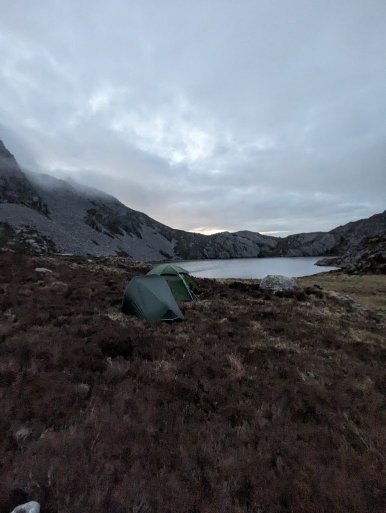 [24] I snapped a moody photo of our campsite with Llyn Hywel lurking atmospherically in the background
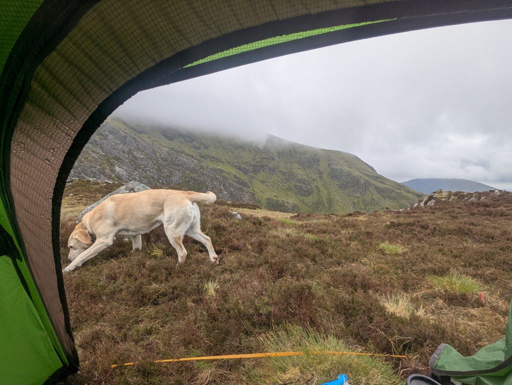 Misty and foggy morning near Llyn Hywel
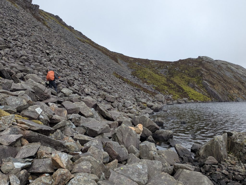 [25] picked our way along the rocky bank until we rejoined the Cambrian Way.
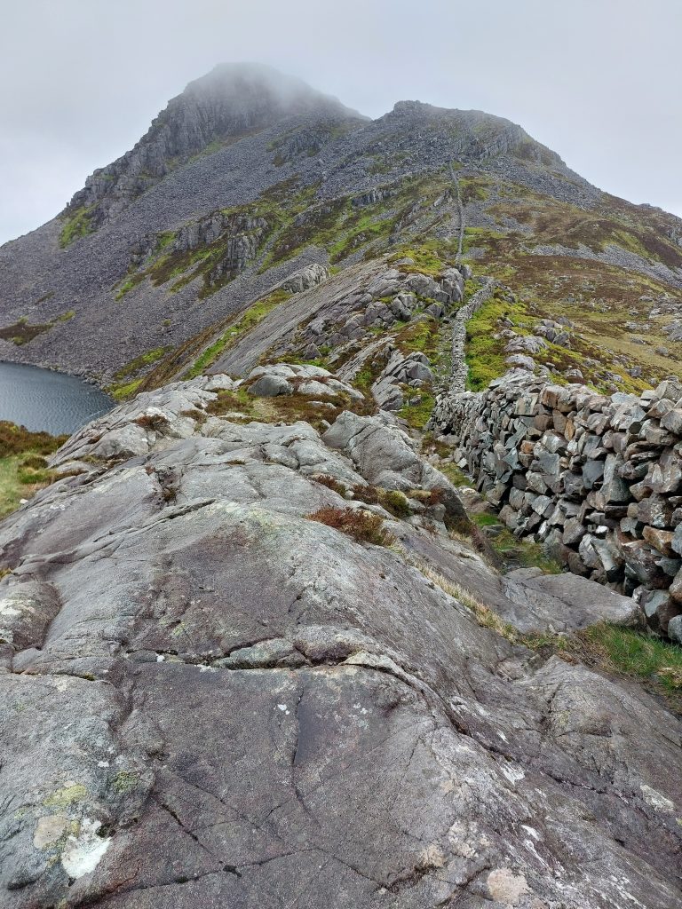 The unrelenting stone wall tracing the spine of the range, offering a handy navigation line when the mist drops [Photo: A. Scibor]
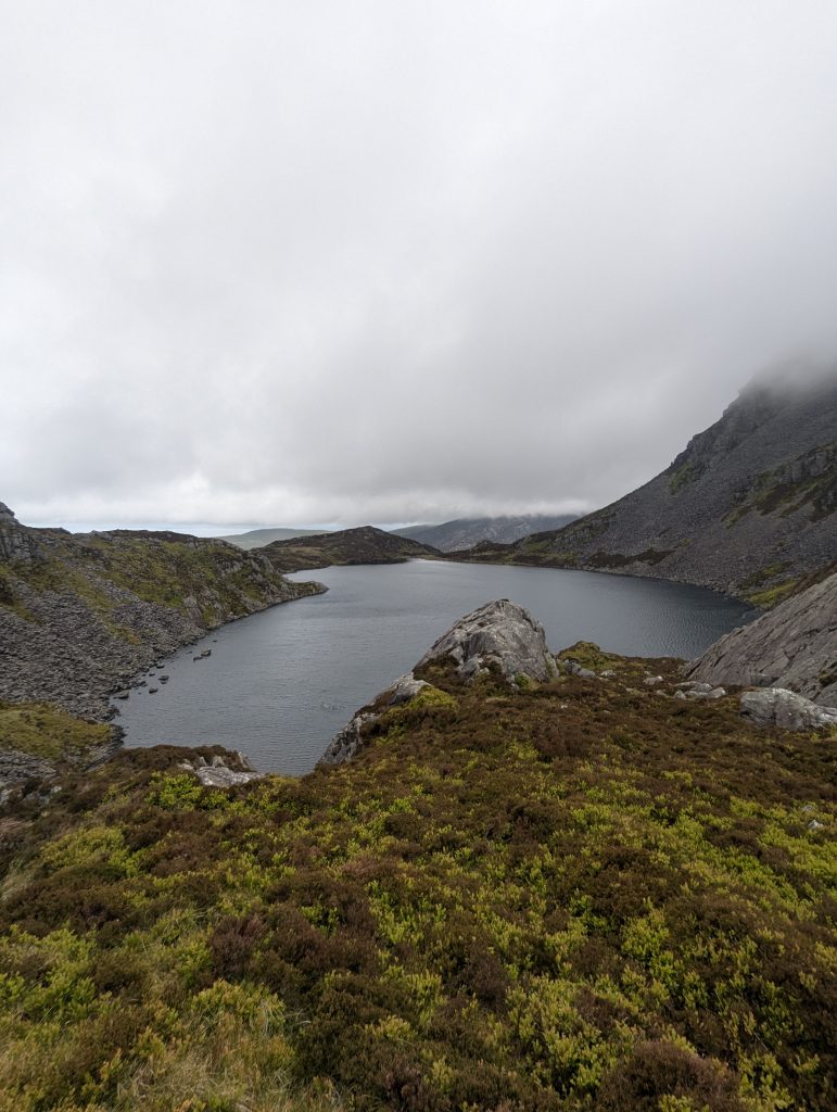 Last look at atmospheric Llyn Hywel
[Photo: A. Scibor]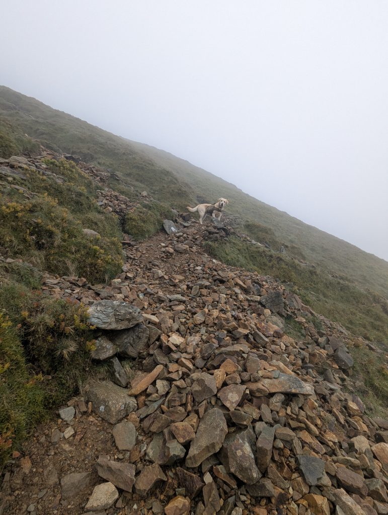 Climb to Craig y Llyn Hywel (558m), Poppy has been ahead of game as always
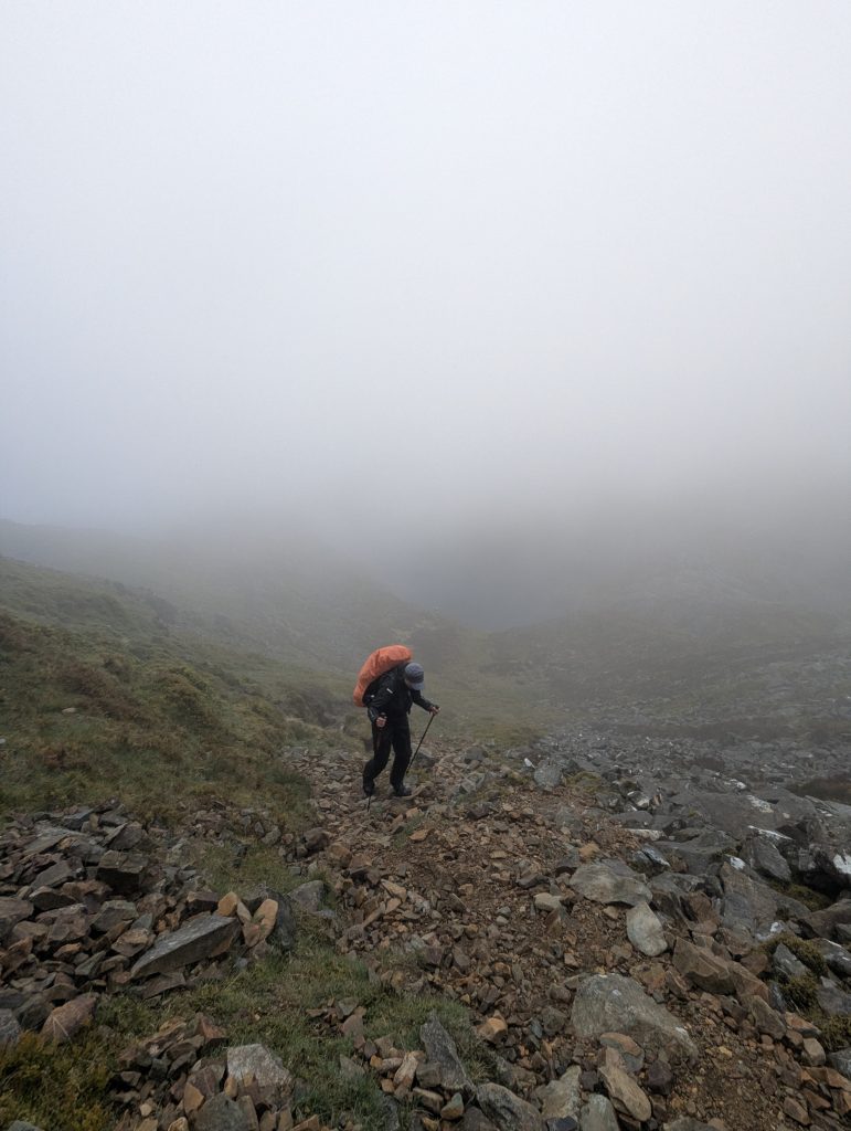 [26] long, steep climb to Craig y Llyn Hywel (558m)
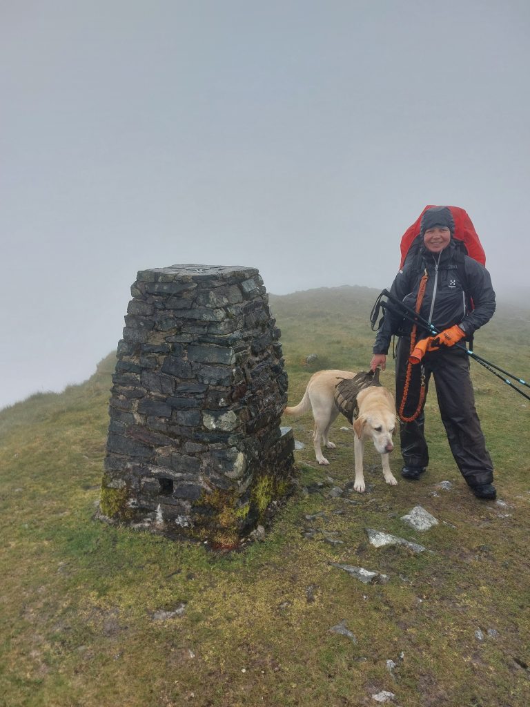 Reaching the summit of Y Llethr in total whiteout conditions, no views, just standard mountain navigation [Photo: A. Scibor]
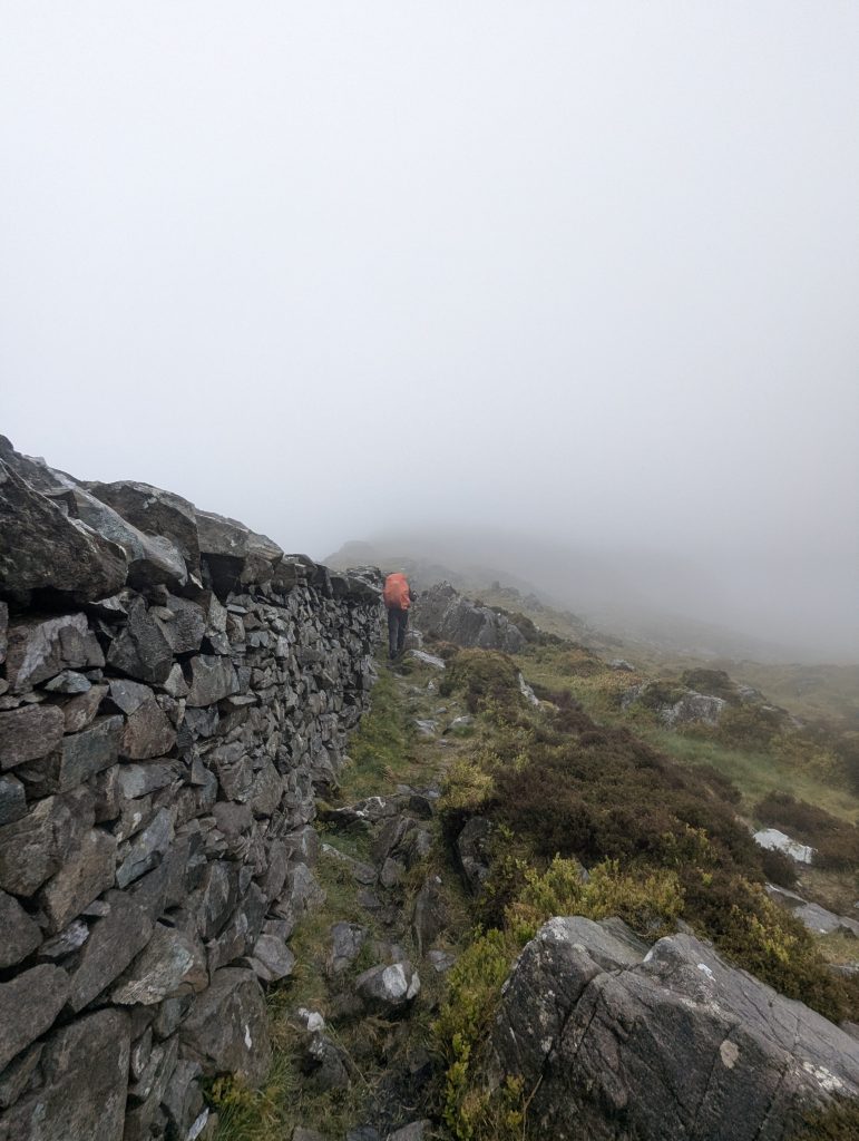 With zero views as incentive, it all felt a bit character-building.
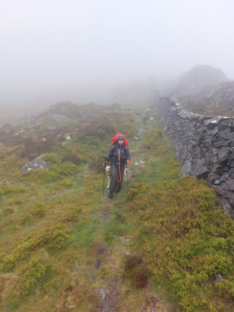 Just keep the wall to your left (until you don’t!) [Photo: A. Scibor]
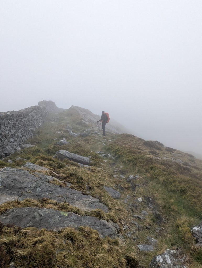 [27] Crib-y-Rhiw, the narrow grassy ridge linking Y Llethr with Diffwys – visibility so bad we might as well have been walking inside a Tupperware box.
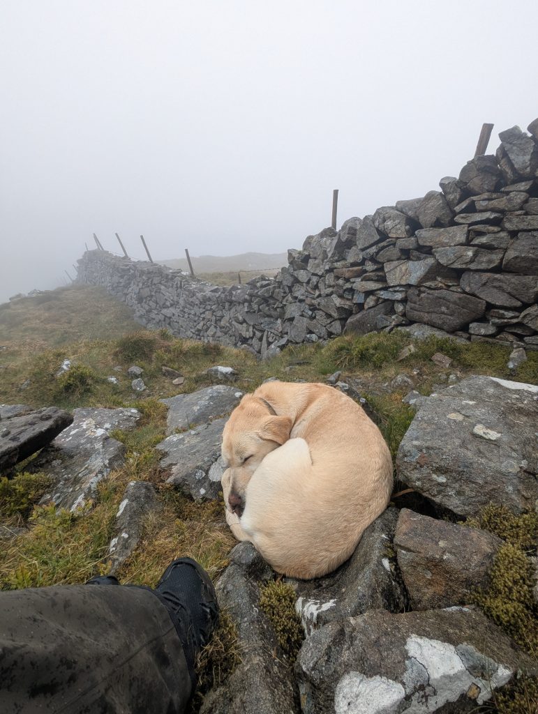 The master of power nap in action
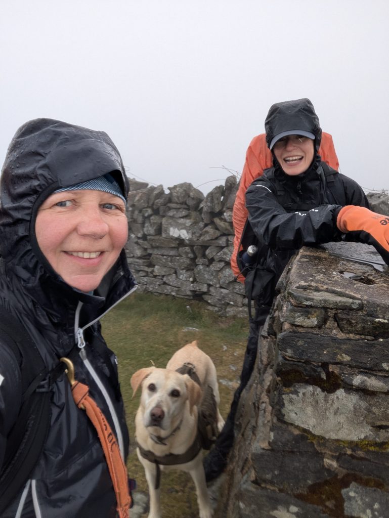 Rhinogydd official Diffwys summit trigpoint
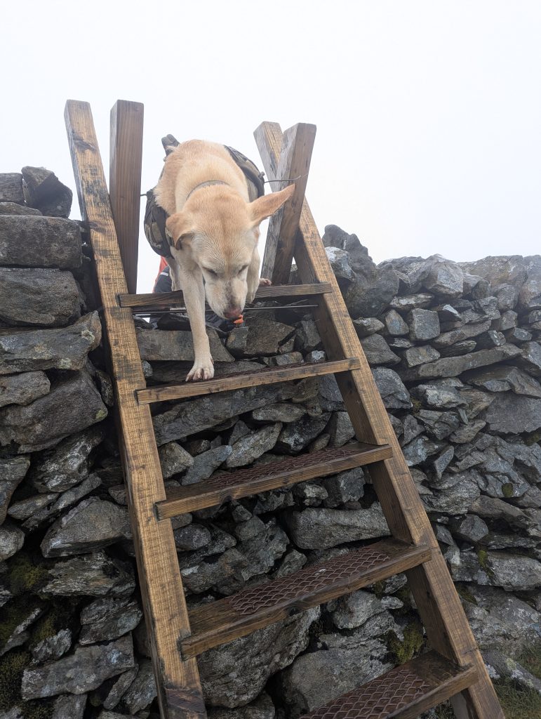 Crossing a suspicious number of A-shaped ladder stiles
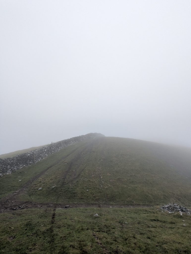 [27] Later, we realised the route actually crossed to the other side of the wall, where the Cambrian Way crosses the Neolithic Trackway
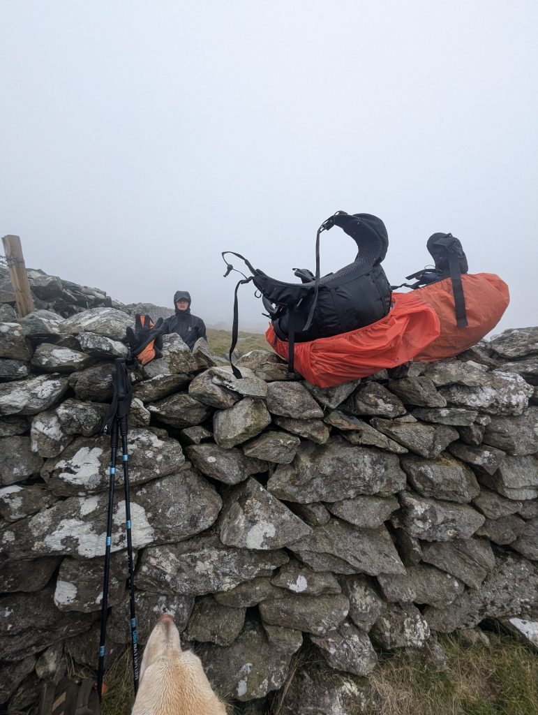 Two walls later, we were back on track
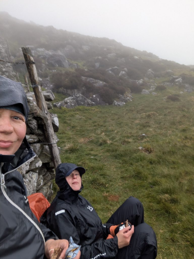 Quick snack break before powering through to Barmouth
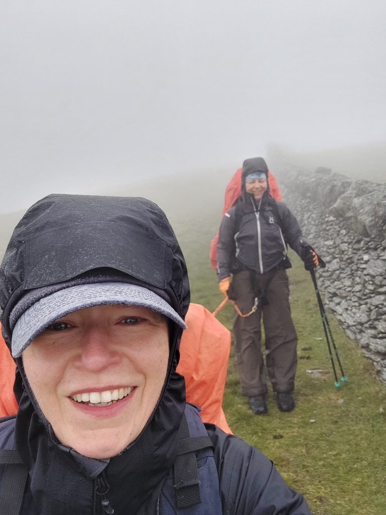 Day three delivered total whiteout conditions, turning the premium ridge views into a game of pure compass bearings [Photo: A. Scibor]
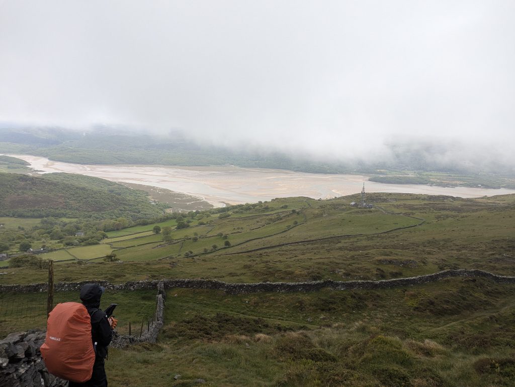 [28] Suddenly, the wind shifted, the clouds blew apart, and what we thought was yet another hill turned out to be the estuary near Barmouth.
Your Questions Answered
How hard is the navigation in the Rhinogydd?
The Rhinog Traverse is considered the roughest section of the Cambrian Way, so the navigation is probably harder than you expect. They’re notorious for being pathless, rocky, and full of misleading trods that disappear exactly when you need them most. Walls and ridgelines help, but you’ll still be making judgment calls all day.
Expect:
🧭 Long stretches with no clear path – just heather, rock, and hope
🪨 Boulder fields where the “route” is whatever looks least sketchy
🌾 Heather and peat that hide micro‑terrain and ankle‑traps
🌫️ Mist that turns everything into a grey riddle
A GPS app like Komoot or AllTrails is essential. Weirdly, my OS Map didn’t show some of the key summit‑crossing paths, so don’t rely on it alone. If you enjoy terrain that keeps your brain switched on, you’ll love it. If you want a clear trail from A to B, this isn’t that kind of party.
Overall: expect slow, careful navigation throughout the Rhinog traverse.
Can you take a dog on the Rhinogs?
Dogs can do the Rhinog traverse, but only if they’re genuinely mountain‑fit.
Yes – but only if your dog is genuinely fit, confident on rock, and used to long days. Some sections, especially on Day 2 around the central Rhinogydd peaks, are simply too technical for short‑legged dogs, so you may need to detour or skip certain summits. You can drop onto the lower‑ground line of the Snowdonia Way in places — it’s a good safety valve if the terrain ahead looks too scrambly.
Expect:
🪜 A‑frame stiles that require lifting or teamwork
🪨 Rough, rocky terrain for long stretches
🐾 Scrambly sections where dogs may need spotting or an alternative line
If your dog thrives on adventure and you’re happy to adapt the route when needed, it’s a brilliant shared challenge. If your dog prefers smooth trails and predictable footing, this traverse will feel like too much.
In short: only confident, fit dogs should attempt the Rhinog traverse
Where do you park for the Rhinogydd Traverse?
Parking for the Rhinog traverse takes a bit of planning.
Long‑term parking can be a bit of a puzzle. We couldn’t pre‑book anything in Barmouth, so we left the car in Dolgellau at the Co‑op using the JustPark app – reasonably priced but turned a very busy car park. From there, we hopped on the T2 bus to Trawsfynydd to start the route. At the end of the hike, the T3 bus runs regularly-ish between Barmouth and Dolgellau, making the loop back to the car straightforward.
This setup works well for a point‑to‑point Rhinog traverse.
What’s your water filtration set-up?
Water is available on the Rhinog traverse, but you must treat it.
I use the Sawyer Squeeze Water Filtration System, Cnoc Premium 2 Litre Bladder – purchased from Amazon for £60.
A filtration system is essential — there are no resupply points on the route.
Is wild camping allowed in the Rhinogydd
Wild camping on the Rhinog traverse is tolerated but not legally permitted.
Technically, wild camping is illegal in Wales without the landowner’s permission, but in the Rhinogydd it’s generally tolerated if you’re discreet, respectful, and follow leave‑no‑trace principles. The terrain is the real gatekeeper here: rough, rocky, and often waterlogged, so finding a decent pitch takes patience and sometimes a bit of backtracking.
Expect:
🪨 Limited flat ground – tiny shelves or grassy pockets between boulder
🌧️ Boggy basins around lakes that look perfect until you step on them
💨 Wind‑funneled ridges where shelter is rare
There is a potential fallback: a small honesty‑box campsite near Llyn Cwm Bychan, just north of Rhinog Fawr. I’ve read about it but haven’t verified it myself, so treat it as a “likely but not guaranteed” option.
If you enjoy remote, scrappy camps, the Rhinog traverse is perfect.
Can I do the traverse in a weekend / 2 days?
A 2‑day Rhinog traverse is possible — but only for fast, confident hikers.
Yes — but only if you’re fast, efficient on technical terrain, and have your logistics nailed. The Rhinogydd aren’t quick miles, so a 2‑day push is realistic only for people who can move confidently over rough ground and keep breaks short.
To make it work, you’ll need:
🚌 Solid transport logistics – two cars or reliable bus timing at Trawsfynydd/Barmouth
🪨 Good speed on rocky, pathless terrain – no hesitation on boulders or heather
🌅 Early starts – both days, no faff
Two bloggers who inspired me to take on the traverse nailed it over a single weekend, so it’s definitely possible — but they mentioned the car logistics and the Friday‑night sleep were tricky.
Most people will enjoy the Rhinog traverse more over 2.5–3 days.
Is there phone signal on the route?
Phone signal on the Rhinog traverse is patchy but decent on the summits.
On the higher ground and most summits, yes — there’s usually usable coverage. I kept my phone in aeroplane mode for most of the traverse to save battery, but whenever I flicked it back on up high, I had signal. Down in the valleys and at our camp spot, it was either patchy or completely dead.
You can run Komoot in aeroplane mode without any issues — just make sure you load your route while you still have coverage. Once it’s cached, it’ll navigate offline perfectly.
OS Maps Online also works without any phone signal, as long as you’ve downloaded the map area beforehand. It’ll still show your GPS location offline, which makes it a solid backup when the mist rolls in or the terrain gets confusing.
Overall: expect a good signal up high, none down low.
What are the escape routes or bail‑out options
The Rhinog traverse has a few reliable escape lines — but none are quick.
The Rhinogydd don’t offer many easy exits, but there are a few reliable bail‑out lines if the weather turns, you’re running out of daylight, or the terrain ahead looks too scrambly.
The Snowdonia Way runs roughly parallel to the traverse and is generally a lower‑ground, easier line. It’s marked on OS Maps and makes a good fallback if you need to drop height quickly or avoid the central rocky section.
There are also two main roads flanking the range — one to the east and one to the west. They’re not close, but they’re reachable if you commit to descending. Both have public transport links, so once you’re down, you can usually get yourself back to civilisation without too much drama.
Finally, there’s a small road near Llyn Cwm Bychan (where the honesty‑box campsite is). It’s a useful mid‑route escape point if you need to call it a day or reroute.
Plan your bail‑outs before you start — they’re far apart.
What gear is essential for the Rhinogydd
The Rhinog traverse rewards people who pack light but smart.
Besides the obvious — good shoes, waterproofs, and your sleeping + cooking setup – the Rhinogydd demand a bit more thought than a typical weekend in Eyryi.
Here’s what actually matters out there:
🧺 Enough food – there’s nowhere to resupply on the route
💧 A water filtration system – streams/tarns are reliable but you must treat them
🧭 Map & compass – the terrain is too complex to rely on instinct
📱 Your chosen GPX route – I found Komoot especially useful
🔋 A power bank – you will rely on electronics
🦯 Hiking poles – they make negotating the descents, boulder fields, scree, and heather slopes far more efficient
🧤 Builder type rubber‑coated gloves – surprisingly helpful on the scrambly, grippy, awkward rock, especially in soggy weather
The Rhinogydd reward people who pack light but smart. Every item above solves a real problem you’ll meet on the ridge.